
By Donal Hickey
DISTRICT DIRECTOR: DONAL HICKEY / EDITOR: WILLIE WARREn
All the stories and legends of Kerry and especially Killarney – some true, others with a smattering of truth and many others very tall indeed – would fill many books. But, perhaps, the most fascinating story of all is how the place came to be formed.
It’s all about great movements of the Earth, some as far back as 400 million years ago, that have shaped the beautiful landscape. Over time, many changes have sculpted the rugged terrain that has inspired lyrical verse.
Yet, the countless tourists from all over the world, who have visited Killarney since tourism started in the area in the second half of the 18th century, are rarely told about how the place came to be.

Geographers, geologists, biologists and other scientists still study the landscape. The obvious is that the ground now forming Killarney National Park is rock covered by soil, water and flora. The story, however, is all about how that was, and continues to be, shaped by the forces of nature.
Experts tell us that the continents are actually vast plates of rock which sort of float on the less solid layers of rock beneath. Over millions of years, these tectonic plates have moved around the surface of the planet and thrown up vast mountain ranges when they crashed and split from each other.
The story of how Killarney’s landscape came to be formed over that vast period of time is well told by Richard Thorn and Peter Coxon in Chapter 2 of an illuminating book edited by Bill Quirke, Killarney National Park – a Place to Treasure.
Prompting a bit of innovative thinking, they suggest that we imagine ourselves as passengers in a satellite orbiting the Earth 400 million years ago and looking out for the piece of the planet’s crust that’s now Killarney and south-west Ireland.
“We would seek in vain the northern latitudes where Ireland now lies,’’ they write. “To succeed, we would have to direct our orbit well to the south of the equator.’’
Our section of the planet is part of a large continental mass including Europe and North America which once lay somewhere between the equator and Brisbane, Australia.
About 290 million years ago, tectonic plates carrying the continent of Africa collided with the plate carrying Ireland and Europe. In Cork and Kerry, the layers of sedimented rock that had formed beneath the ocean were violently disturbed, raising them high above the waves into high mountains. This pattern can be seen to this day in the mountains we see all around us.
Now let us move the clock forward to the Frost and Ice Age, between two million years ago and 10,000 years ago. The movement of melting glaciers helped to further sculpt the landscape and left many of the ice-created features we still see in the mountains and valleys of Kerry to this day.
The unrelenting process of erosion and landscape-shaping continues. “What the future holds for the Killarney landscape we can only guess,’’ Thorn and Coxon note tantalisingly.
Acknowledgements:
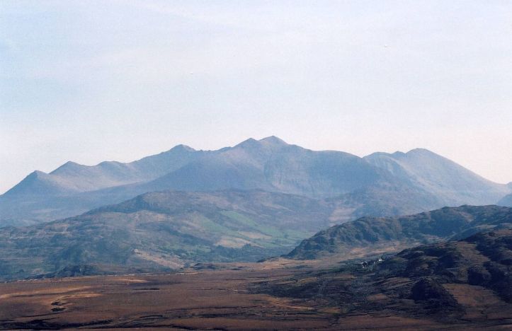
Image of MacGillycuddy’s Reeksby Matpib – Self-photographed, CC BY-SA 3.0, https://commons.wikimedia.org/w/index.php?curid=2008805.
About the author
Donal Hickey worked as a journalist with Examiner Newspapers, Cork, for 40 years. He was the Irish Examiner’s environment correspondent for a number of years and continues to write a weekly column on such issues for the paper. He is the long-time editor of the local history publication, Sliabh Luachra Journal, and is the author of a number of books, the most recent being The Healy-Raes – a 24/7 political legacy. He lives in Killarney.

Donal Hickey’s story on The Timeless Landscape of Kerry and Killarney – Dates like 400 million years ago, 290 million, 2 million and 10,000 .. a land that at one time was under the sea, was 30 degrees south of the equator, was part of enormous land mass that crashed with another of similar size .. this must have been the most violent collision the world has ever experienced .. the mind boggles .. imagine the endless layers of stories all of this must have to tell?